

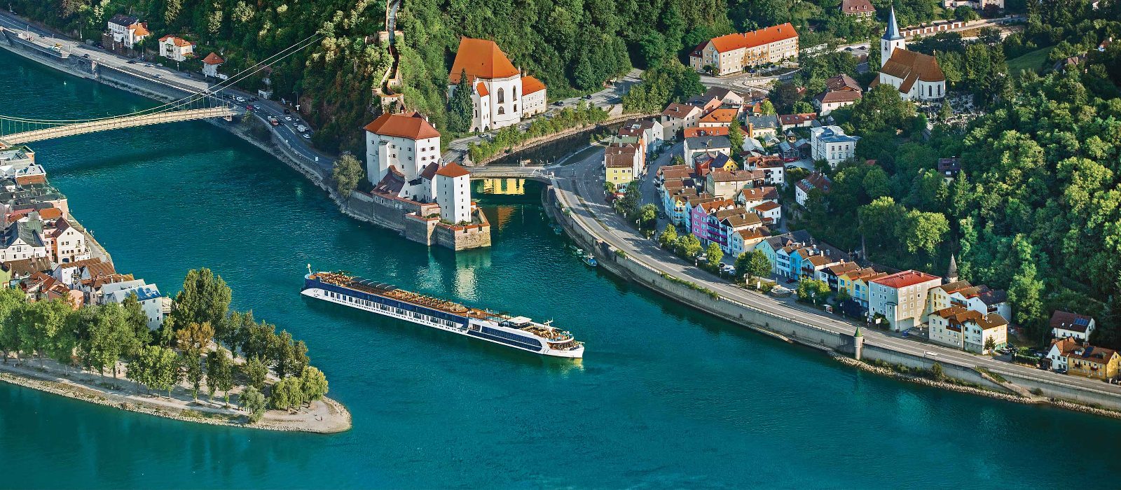
Quick answer
A Danube River cruise map traces the waterway's course from its German source through Austria, Slovakia, Hungary, Croatia, Serbia, Bulgaria, and Romania to its Black Sea delta. The river is accessible for navigation year-round, with cruise vessels operating primarily between April and November. Most itineraries concentrate on the Upper and Middle Danube sections, where historic cities like Vienna, Bratislava, and Belgrade line the banks at intervals of 50 to 150 kilometers.
The Danube crosses more national borders than any other river on Earth, yet fewer than half of casual travelers can name more than three countries along its path. This geographic complexity explains why cartographic orientation matters before committing to a seven- or fourteen-day voyage. The Upper Danube runs from Passau through Austria's Wachau Valley to Vienna, a 290-kilometer segment framed by vineyard terraces and baroque abbeys. Vessels navigate a series of locks and shallow channels that restrict ship draft to 1.4 meters during low-water periods. The Middle Danube continues from Vienna through Bratislava and Budapest to the Croatian-Serbian border, covering 650 kilometers of broader, faster-moving water. Navigation charts for this section highlight the river's transition from Alpine meltwater clarity to the silt-laden current that characterizes the Lower Danube. Beyond Belgrade, the river enters the Iron Gates gorge, where Romanian and Serbian cliffs compress the channel to 150 meters. This 130-kilometer passage features Europe's largest river dam and requires pilots familiar with cross-currents and submerged rock formations. The final 860 kilometers to the Black Sea traverse Romania's agrarian flatlands, where the Danube splits into three delta branches near Tulcea. Few commercial cruise operators venture past this point due to shallow draft requirements and limited port infrastructure. A Danube River cruise map serves as the foundation for comparing itinerary options, not as a substitute for operator-specific route documentation. Eastbound and westbound voyages cover identical ports but reverse the sequence of cultural immersion—Vienna early versus Vienna late changes how travelers process Habsburg architecture against Ottoman influences downstream. Seasonal water levels also dictate whether ships can pass under certain bridges or must reroute passengers via motorcoach between segments, a logistical reality that maps alone do not communicate.
“The Danube crosses more national borders than any other river on Earth, yet fewer than half of casual travelers can name more than three countries along its path.”
Danube River Cruise Map — Navigating the European Waterway
This itinerary guides you through the main cruise route segments from Germany to the Black Sea, typically covered over 7-14 days depending on the operator. It outlines the geographic progression and major port stops where vessels dock for land excursions.
Passau to Vienna
Embark in Passau, Germany, and cruise southeast through the Wachau Valley wine region into Austria. Vienna marks the first major capital stop, usually with 4-6 hours docked for city exploration.
Vienna to Budapest
Continue through Slovakia's Bratislava, then enter Hungary. Budapest offers extended mooring time, often overnight, allowing evening views of the illuminated Parliament building from the river.
Hungarian Plains to Belgrade
Pass through the Great Hungarian Plain and cross into Serbia. Belgrade provides access to the confluence of the Sava and Danube rivers, with vessels typically docking near Kalemegdan Fortress.
Iron Gates to Giurgiu
Navigate the Iron Gates gorge between Serbia and Romania, the river's narrowest and deepest section. Romanian ports like Giurgiu allow transfers to Bucharest, roughly 70 km inland.
Rousse to Danube Delta
Cross into Bulgaria at Rousse, then re-enter Romania for the final stretch. The river splits into three main channels before reaching Tulcea, the gateway to the UNESCO-protected Danube Delta wetlands.
Key Landmarks on Your Danube River Cruise Map
Standard cruise maps highlight several key architectural and historical landmarks along the Danube River. These sites define the riverbanks as you navigate through Central and Eastern Europe.
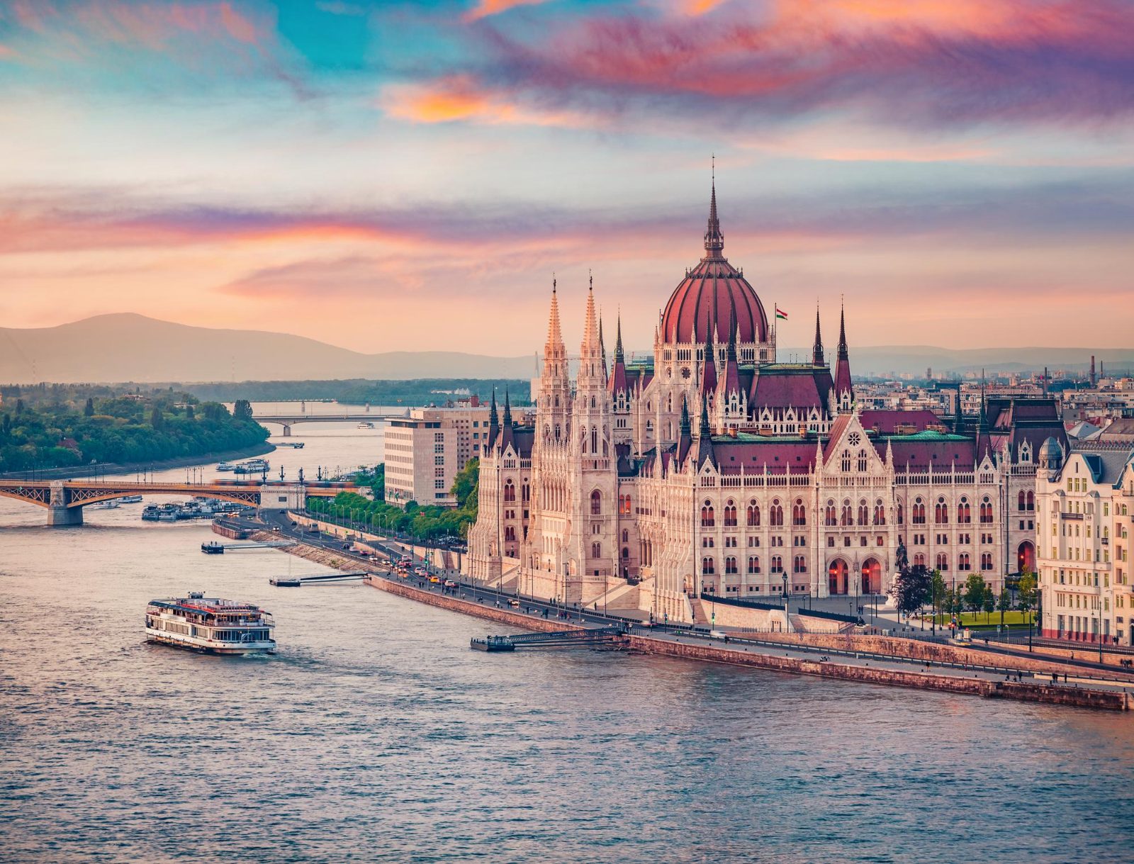
Budapest Parliament Building
This neo-Gothic structure features a prominent central dome and sits directly on the Pest bank of the river.
View from the water at night for illuminated facade details.
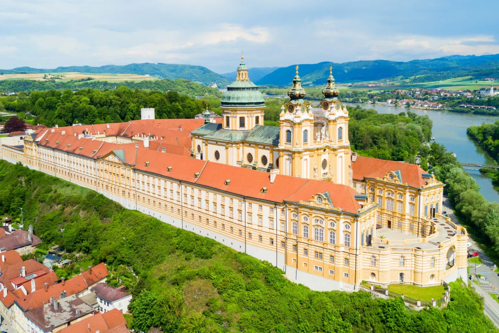
Melk Abbey
A Benedictine abbey located on a rocky outcrop overlooking the Danube in the Wachau Valley.
Use binoculars to spot the intricate yellow baroque architecture.
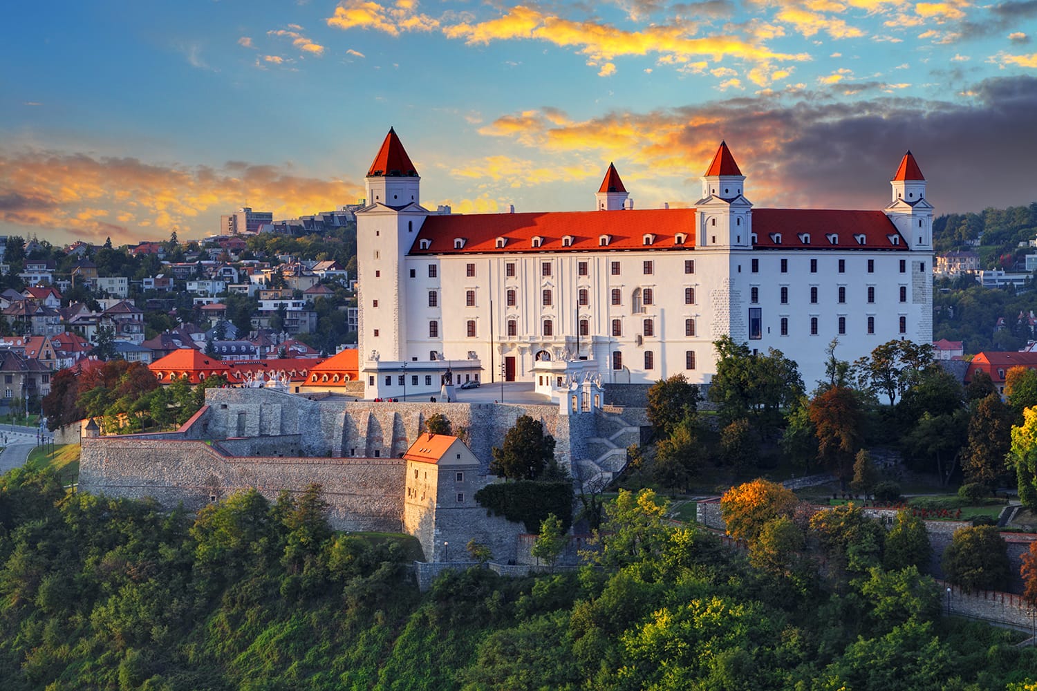
Bratislava Castle
Situated on a plateau above the Danube, this rectangular castle dominates the skyline of the Slovak capital.
Observe the four corner towers while passing through the city center.
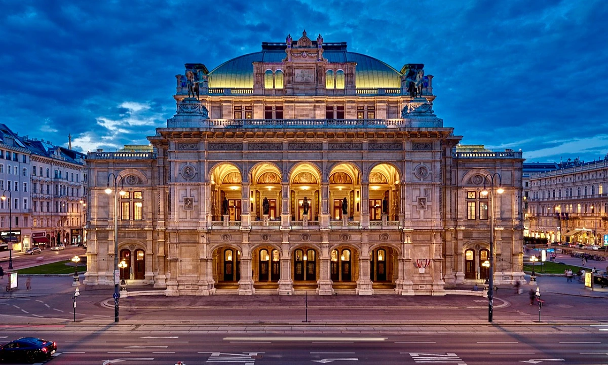
Vienna State Opera
Located near the riverbank, this building represents the cultural significance of Austria's capital.
Look for the neo-Renaissance arches when walking from the cruise dock.
Danube River Cruise Map — Daily Operational Hours
The Danube River functions as a navigable waterway 24 hours a day. Specific cruise departure times remain dependent on the schedule set by individual operators.
| Monday | 00:00–23:59 | |
|---|---|---|
| Tuesday | 00:00–23:59 | |
| Wednesday | 00:00–23:59 | |
| Thursday | 00:00–23:59 | |
| Friday | 00:00–23:59 | |
| Saturday | 00:00–23:59 | |
| Sunday | 00:00–23:59 |
Danube River Cruise Map — Fee Information
Access to the Danube River itself is free of charge. Actual cruise costs are determined exclusively by the specific operator and service package selected.
While the river is free to access, individual cruise operators set their own pricing based on the chosen itinerary and service level.
Accessing Your Danube River Cruise Map Starting Points
The Danube River spans Central and Eastern Europe, with major embarkation points located in cities such as Vienna, Budapest, and Passau. Most international travelers reach these hubs via major rail lines or international airports serving the river region.
Railjet to Wien Hauptbahnhof
Line M2 to Batthyány tér (Budapest)
River shuttle to central piers
Direct transfer to river terminal
Check availability
Frequently asked questions about danube river cruise map
Everything you need to know about danube river cruise map